CLOSED ON JULY 4TH! Current hours: 10am to 5pm Monday through Saturday and 12-5 on Sundays. Proud to be a SMALL, LOCAL, CAPE COD BUSINESS! Maps of Antiquity is in its 38th year! Our maps are only available at our website www.mapsofantiquity.com or at our store!

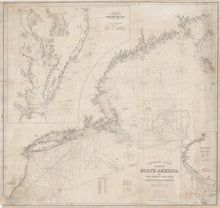
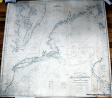
A mostly black and white antique sailing chart with some original hand-coloring on the locations of lighthouses and light ships, lightly tanned background from age.
A mostly black and white antique sailing chart with some original hand-coloring on the locations of lighthouses and light ships, lightly tanned background from age. Black-and-White-Antique--Nautical-Chart-Eldridge's-Chart-Coast-of-North-America-No.-2-Cape-Henry-to-Cape-Sable.--Nautical--1882-Eldridge-Maps-Of-Antiquity
  • Load image into Gallery viewer, A mostly black and white antique sailing chart with some original hand-coloring on the locations of lighthouses and light ships, lightly tanned background from age.
  • Load image into Gallery viewer, A mostly black and white antique sailing chart with some original hand-coloring on the locations of lighthouses and light ships, lightly tanned background from age. Black-and-White-Antique--Nautical-Chart-Eldridge's-Chart-Coast-of-North-America-No.-2-Cape-Henry-to-Cape-Sable.--Nautical--1882-Eldridge-Maps-Of-Antiquity

1882 - Eldridge's Chart, Coast of North America, No. 2, Cape Henry to Cape Sable. - Antique Chart

Regular price
$2,300.00
Sale price
$2,300.00
Regular price
Sold out
Unit price
per 
Shipping calculated at checkout.

Item number: NAU132

Genuine Antique Nautical Chart

1882

Maker: Eldridge.


Antique sailing chart published by George W. Eldridge in 1882, showing the Northeast Coast from Cape May to Nova Scotia. Includes the New Jersey Coast, New York City and Harbor, Long Island and Long Island Sound, Cape Cod, Cape Ann, the Maine Coast, and more. With insets of the Sea Coast from Cape Henlopen to Cape Henry, including the Chesapeake Bay, and of the Delaware Bay and River. Eldridge was competing for business with the Federal Government, which produced charts using information from both the US Coast Survey and US Geological Survey, which resulted in charts full of topographic information. Eldridge eliminated from his charts any information that was not necessary to sailors, creating simplified, easy to use charts that appealed to no-nonsense seamen. The result is a graphic style that is highly appreciated today. Very good restored condition, has been re-backed in linen, smooth overall toning, some staining lower right. Approx. 42.75 x 44.25. Photo 1 is a high-quality scan of the chart and photo 2 is a picture taken in the shop (the lighting was not great but we feel this photo is helpful). **NOTE- because this map requires extra insurance for shipping, the shipping cost is higher than usual. If you would prefer the chart is shipped without insurance, please contact us.**

Genuine Antique Chart from 1882

Item Number: NAU132