Current hours: 10am to 5pm Monday through Saturday. 12pm to 5pm Sundays. IMPORTANT PLEASE NOTE: We have become aware that some of our photos have been stolen by other websites. Our maps are only available at our website www.mapsofantiquity.com or at our store!

Genuine-Antique-Map,-Framed-Plans-of-the-Cities-and-Harbors-of-New-York,-Boston,-Charleston,-Havanna,-and-Philadelphia-1782-T.-Conder-Maps-Of-Antiquity
  • Load image into Gallery viewer, Genuine-Antique-Map,-Framed-Plans-of-the-Cities-and-Harbors-of-New-York,-Boston,-Charleston,-Havanna,-and-Philadelphia-1782-T.-Conder-Maps-Of-Antiquity
  • Load image into Gallery viewer, Genuine-Antique-Map,-Framed-Plans-of-the-Cities-and-Harbors-of-New-York,-Boston,-Charleston,-Havanna,-and-Philadelphia-1782-T.-Conder-Maps-Of-Antiquity

1782 - Plans of the Cities and Harbors of New York, Boston, Charleston, Havana, and Philadelphia - Antique Map

Regular price
$450.00
Sale price
$450.00
Regular price
Sold out
Unit price
per 
Shipping calculated at checkout.

Item number: TOW661

Genuine Antique Map, Framed

1782

Maker: T. Conder


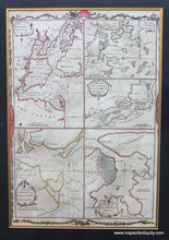
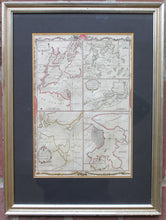
Antique sheet of five Revolutionary War era harbor plans, based upon larger maps of the period, by T. Conder, 1782. The titles of the plans are: Plan of the Harbour of New-York and Parts adjacent; The Town & Harbour of Boston &c.; Draught of the River Delaware from Chester to Philadelphia; Plan of the Harbour of Charles Town, South Carolina; Plan of the City & Harbour of Havanna, Capital of Cuba. Decorative border around the entire sheet. Framed. Original hand-coloring with later touch ups. Framing may not be archival and should probably be reframed. Can be shipped for less if shipped without the frame (price of the map remains the same). Measures approx. 8.25 x 11.5 inches to the neatline and 17.25 x 13 inches to the frame edges.


Item Number: TOW661