1874
Maker: Mitchell.
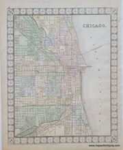
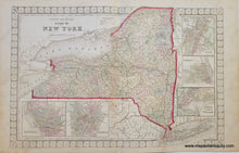
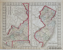
Antique double-sided page with four maps. The centerfold map is of New York state with inset maps of Troy & West Troy, Albany, Harbor and Vicinity of New York City, Rochester, and Buffalo. Shows topographical detail, railroads, and canals. On the versos are maps of New Jersey and Maryland and Delaware on one side, and a map of Chicago on the other side. Drawn and Engraved by W.H. Gamble, published and copyrighted by S. Augustus Mitchell, 1874. This map features a very unique decorative border- we have never seen any maps with this particular border design! Very good overall antique condition with a small tear at bottom and into the border in the NY and Chicago maps. NY map measures approximately 14" x 21.25" to outer edge of decorative border. Chicago map measures approx. 13.5 x 11 inches to the outer edge of the decorative border.
Item Number: NYO001


