Winter hours: Tuesday - Saturday 10am to 5pm. Close Sundays and Mondays until May. We appreciate your business!

Antique-Hand-Colored-Map-Pennsylvania-Philadelphia-Gray's-Atlas-City-of-Baltimore-United-States-Maryland-1874-Gray-Maps-Of-Antiquity
  • Load image into Gallery viewer, Antique-Hand-Colored-Map-Pennsylvania-Philadelphia-Gray's-Atlas-City-of-Baltimore-United-States-Maryland-1874-Gray-Maps-Of-Antiquity
  • Load image into Gallery viewer, Antique-Hand-Colored-Map-Pennsylvania-Philadelphia-Gray's-Atlas-City-of-Baltimore-United-States-Maryland-1874-Gray-Maps-Of-Antiquity
  • Load image into Gallery viewer, Antique-Hand-Colored-Map-Pennsylvania-Philadelphia-Gray's-Atlas-City-of-Baltimore-United-States-Maryland-1874-Gray-Maps-Of-Antiquity

1873 - Pennsylvania, Philadelphia, Gray's Atlas City of Baltimore - Antique Map

Regular price
$125.00
Sale price
$125.00
Regular price
Sold out
Unit price
per 
Shipping calculated at checkout.

Item number: MAT116
Genuine Antique Hand-Colored Map

1873

Maker: Gray.


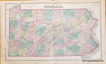
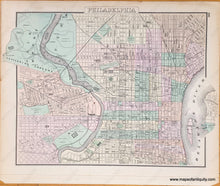
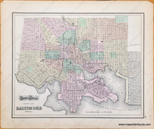
Antique double-sided map from "Gray's Atlas of the U.S. with General Maps of the World". One side has larger map of Pennsylvania (centerfold). Shows townships, cities, land forms, bodies of water, rivers, canals, and railroads. The opposite side has two smaller maps, one of Baltimore, and one of Philadelphia. These show roads, buildings, parks, rivers, canals, and railroads. Good overall antique condition with some mild toning and stains, as well as some small tears at the outer edges. PA map measures approx. 15.5 x 26.5 inches. Baltimore or Philadelphia maps are 15 x 12.5 inches 


Item Number: MAT116