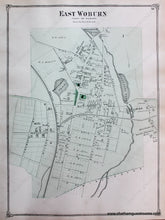
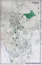
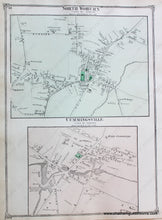
1875 - Double-sided page with several maps: East Woburn, Woburn (Center), North Woburn, Cummingsville (MA) - Antique Map
Antique-Hand-Colored-Map-East-Woburn-Woburn-(Center)-North-Woburn-Cummingsville-(MA)-Middlesex--1875-Beers-Maps-Of-Antiquity
1875 - Double-sided page with several maps: East Woburn, Woburn (Center), North Woburn, Cummingsville (MA) - Antique Map
  • Load image into Gallery viewer, 1875 - Double-sided page with several maps: East Woburn, Woburn (Center), North Woburn, Cummingsville (MA) - Antique Map
  • Load image into Gallery viewer, Antique-Hand-Colored-Map-East-Woburn-Woburn-(Center)-North-Woburn-Cummingsville-(MA)-Middlesex--1875-Beers-Maps-Of-Antiquity
  • Load image into Gallery viewer, 1875 - Double-sided page with several maps: East Woburn, Woburn (Center), North Woburn, Cummingsville (MA) - Antique Map

1875 - Double-sided page with several maps: East Woburn, Woburn (Center), North Woburn, Cummingsville (MA) - Antique Map

Regular price
$75.00
Sale price
$75.00
Regular price
Sold out
Unit price
per 
Shipping calculated at checkout.

Item number: MAS627

Genuine Antique Hand Colored Map

1875

Maker: Beers.


Antique double-sided page. Centerfold map is Woburn (Center). On the other sides are East Woburn and North Woburn with Cummingsville. From the Middlesex County Atlas, Beers& Co., approx. 14 x 22 inches, hand colored, in good to very good condition.  Full  page, $135.00,  smaller maps (East Woburn or North Woburn) can be purchased separately for  $75.00.


Item Number: MAS627