1900
Maker: Cram.
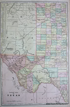
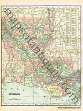
Antique printed color double-sided sheet of the Western half of Texas (Recto). Features a list of counties and chief cities. Verso (Two Maps) A map of Mississippi and a map of Louisiana. Both of these maps include lists of counties and chief cities; however, the list for Mississippi falls outside of the neatlines. Very good condition with some slight overall toning and a small tear at the fold. By Cram, in Cram's Universal Atlas Geographical, Astronomical and Historical, 1900. Recto Map (Western Half of Texas) measures approximately 20.5" x 13.25" to the neatline. Map of Mississippi measures approx. 13" x 9.5" to the neatline. (Note: List of counties and chief cities lies outside of the neatlines of the Mississippi map.) Map of Louisiana measures approx. 12.5" x 10" to the neatline. If you would like to purchase any of these maps separate from the others, please contact us.
Item Number: SOU310


