Current hours: 10am to 5pm Monday through Saturday. 12pm to 5pm Sundays. We are CLOSED on Christmas Day and New Years Day. We will close early (3pm) on Christmas Eve. IMPORTANT PLEASE NOTE: We have become aware that some of our photos have been stolen by other websites. Our maps are only available at our website www.mapsofantiquity.com or at our store!

Antique-Coastal-Chart-Caribbean-Sea---Blunt-Blueback-Navigational-Chart-Nautical--1846-Blunt-Maps-Of-Antiquity
1846 - Caribbean Sea Blunt Blueback Navigational Chart Antique Genuine Coastal
  • Load image into Gallery viewer, Antique-Coastal-Chart-Caribbean-Sea---Blunt-Blueback-Navigational-Chart-Nautical--1846-Blunt-Maps-Of-Antiquity
  • Load image into Gallery viewer, 1846 - Caribbean Sea Blunt Blueback Navigational Chart Antique Genuine Coastal
  • Load image into Gallery viewer, 1846 - Caribbean Sea Blunt Blueback Navigational Chart Antique Genuine Coastal
  • Load image into Gallery viewer, 1846 - Caribbean Sea Blunt Blueback Navigational Chart Antique Genuine Coastal
  • Load image into Gallery viewer, 1846 - Caribbean Sea Blunt Blueback Navigational Chart Antique Genuine Coastal

1846 - Caribbean Sea - Blunt Blueback Navigational Chart - Antique Chart

Regular price
$2,500.00
Sale price
$2,500.00
Regular price
Sold out
Unit price
per 
Shipping calculated at checkout.

Item number: NAU144
Genuine Antique Coastal Chart

1846

Maker: Blunt.

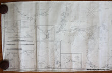
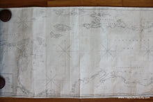
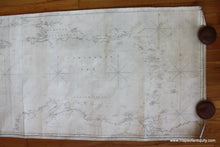
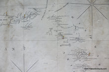
Beautiful antique chart of New Spain, Southern Caribbean. Blue Back Navigational Chart, 3 joined pieces, Mouth of the Orinoco/Trinidad to Veracruz, south coast of Cuba to north coast of South America. 7 inserts include: Port of Veracruz, Port Au Prince, Anton Lizardo, Aguadilla Anchorage, Gulf of Darien, Puerto de Guanica, Jacquemel Harbour. Original color includes lighthouses in red and yellow with the balance of the chart in black and white. Includes 5 recognition profiles. Nautical chart is whole, bound and in original, very good condition, with some vertical creases, minor surface soiling and small water stain in the lower right corner. Measures approx. 25.5 x 84 inches to the bound edges. **NOTE- because this map requires extra insurance for shipping, an additional charge will appear on your card after your original purchase. If you would like to know what that charge will be, please contact us.**

Item Number: NAU144