Current hours: 10am to 5pm Monday through Saturday. Closed on Sundays. IMPORTANT PLEASE NOTE: We have become aware that some of our photos have been stolen by other websites. Our maps are only available at our website www.mapsofantiquity.com or at our store!

Genuine-Antique-Nautical-Chart-Rare-Chart-of-Narragansett-Bay-Surveyed-in-1832-by-Capt-Alex-S-Wadsworth-Lieut-Thos-R-Gedney-Charles-Wilkes-Jr--Geo-S-Blake-Of-the-U-S-Navy-By-order-of-the-Honr-Levi-Woodbury-Secretary-of-the-Navy-1832-Alex-S-Wadsworth-Maps-Of-Antiquity
  • Load image into Gallery viewer, Genuine-Antique-Nautical-Chart-Rare-Chart-of-Narragansett-Bay-Surveyed-in-1832-by-Capt-Alex-S-Wadsworth-Lieut-Thos-R-Gedney-Charles-Wilkes-Jr--Geo-S-Blake-Of-the-U-S-Navy-By-order-of-the-Honr-Levi-Woodbury-Secretary-of-the-Navy-1832-Alex-S-Wadsworth-Maps-Of-Antiquity
  • Load image into Gallery viewer, Genuine-Antique-Nautical-Chart-Rare-Chart-of-Narragansett-Bay-Surveyed-in-1832-by-Capt-Alex-S-Wadsworth-Lieut-Thos-R-Gedney-Charles-Wilkes-Jr--Geo-S-Blake-Of-the-U-S-Navy-By-order-of-the-Honr-Levi-Woodbury-Secretary-of-the-Navy-1832-Alex-S-Wadsworth-Maps-Of-Antiquity
  • Load image into Gallery viewer, Genuine-Antique-Nautical-Chart-Rare-Chart-of-Narragansett-Bay-Surveyed-in-1832-by-Capt-Alex-S-Wadsworth-Lieut-Thos-R-Gedney-Charles-Wilkes-Jr--Geo-S-Blake-Of-the-U-S-Navy-By-order-of-the-Honr-Levi-Woodbury-Secretary-of-the-Navy-1832-Alex-S-Wadsworth-Maps-Of-Antiquity
  • Load image into Gallery viewer, Genuine-Antique-Nautical-Chart-Rare-Chart-of-Narragansett-Bay-Surveyed-in-1832-by-Capt-Alex-S-Wadsworth-Lieut-Thos-R-Gedney-Charles-Wilkes-Jr--Geo-S-Blake-Of-the-U-S-Navy-By-order-of-the-Honr-Levi-Woodbury-Secretary-of-the-Navy-1832-Alex-S-Wadsworth-Maps-Of-Antiquity
  • Load image into Gallery viewer, Genuine-Antique-Nautical-Chart-Rare-Chart-of-Narragansett-Bay-Surveyed-in-1832-by-Capt-Alex-S-Wadsworth-Lieut-Thos-R-Gedney-Charles-Wilkes-Jr--Geo-S-Blake-Of-the-U-S-Navy-By-order-of-the-Honr-Levi-Woodbury-Secretary-of-the-Navy-1832-Alex-S-Wadsworth-Maps-Of-Antiquity
  • Load image into Gallery viewer, Genuine-Antique-Nautical-Chart-Rare-Chart-of-Narragansett-Bay-Surveyed-in-1832-by-Capt-Alex-S-Wadsworth-Lieut-Thos-R-Gedney-Charles-Wilkes-Jr--Geo-S-Blake-Of-the-U-S-Navy-By-order-of-the-Honr-Levi-Woodbury-Secretary-of-the-Navy-1832-Alex-S-Wadsworth-Maps-Of-Antiquity

1832 - Rare Chart of Narragansett Bay, Surveyed in 1832 by Capt. Alex. S. Wadsworth, Lieut. Thos. R. Gedney, Charles Wilkes Jr. & Geo. S. Blake Of the U.S. Navy By order of the Honr. Levi Woodbury Secretary of the Navy - Antique Chart

Regular price
$4,950.00
Sale price
$4,950.00
Regular price
Sold out
Unit price
per 
Shipping calculated at checkout.

Item number: NAU400
Genuine Antique Nautical Chart

1832

Maker: Alex S. Wadsworth

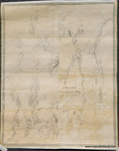
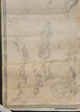
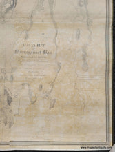
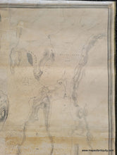
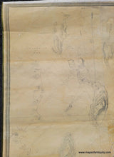
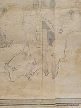
Rare early chart of Narragansett Bay, engraved by W.J. Stone, published c. 1832. This chart is the result of the first systematic survey of Narragansett Bay in the 19th century and is far more detailed than earlier surveys and charts. On the chart are the towns of Newport, Bristol and Wickford. It includes navigational information such as soundings, hazards and lighthouses with additional detail of topography, islands, beaches, vegetation, marshes, ferry landings, and more. This chart has been archivally restored- cleaned, deacidified, backed on linen, with any missing areas filled in. It could be framed or hung on rods. Very good restored condition with some signs of age. Measures approx. 52.5 x 41 inches to the inner neatline. Overall size is approx. 56 x 44 inches.

Item Number: NAU400