Black-&-White-Antique-Nautical-Chart-Bermuda-Islands.-From-the-most-recent-Brit.-Admty.-Surveys.-Antique-Nautical-Charts-Central-America-and-Caribbean-1877-Hydrographic-Office-US-Navy-Maps-Of-Antiquity
1877 - Bermuda Islands. From the most recent Brit. Admty. Surveys. - Antique Chart
  • Load image into Gallery viewer, Black-&-White-Antique-Nautical-Chart-Bermuda-Islands.-From-the-most-recent-Brit.-Admty.-Surveys.-Antique-Nautical-Charts-Central-America-and-Caribbean-1877-Hydrographic-Office-US-Navy-Maps-Of-Antiquity
  • Load image into Gallery viewer, 1877 - Bermuda Islands. From the most recent Brit. Admty. Surveys. - Antique Chart
  • Load image into Gallery viewer, 1877 - Bermuda Islands. From the most recent Brit. Admty. Surveys. - Antique Chart
  • Load image into Gallery viewer, 1877 - Bermuda Islands. From the most recent Brit. Admty. Surveys. - Antique Chart
  • Load image into Gallery viewer, 1877 - Bermuda Islands. From the most recent Brit. Admty. Surveys. - Antique Chart

1877 - Bermuda Islands. From the most recent Brit. Admty. Surveys. - Antique Chart

Regular price
$1,750.00
Sale price
$1,750.00
Regular price
Sold out
Unit price
per 
Shipping calculated at checkout.

Item number: NAU287
Black & White Genuine Antique Nautical Chart

1877

Maker: Hydrographic Office, US Navy.

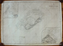
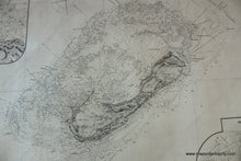
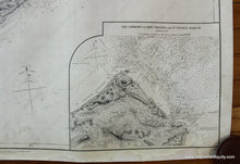
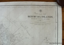
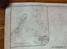
Antique uncolored nautical chart of Bermuda, by the Hydrographic Office, US Navy, 1877. This detailed chart shows the many islands of Bermuda with soundings to aid navigation for safe passage. Three inset maps that are titled: Grassy Bay and Ireland Island; The Banks S.W. of the Bermudas; The Narrows or Ship Channel and St George Harbor. Six compasses, four of which show the magnetic compass versus the true compass readings. This chart has been professionally restored - cleaned, deacidified, and rebacked with linen. Very good restored condition. Some light stains are still visible. The chart was damaged on the bottom edge and the damaged areas have been filled in to be barely noticeable (mostly in margin) Approx. 28 x 39 inches to the neatline, and 30 x 40.5 inches to the paper edges. **NOTE- because this map requires extra insurance for shipping, an additional charge will appear on your card after your original purchase. If you would like to know what that charge will be, please contact us.**

Item Number: NAU287