Current hours: 10am to 5pm Monday through Saturday. 12pm to 5pm Sundays. IMPORTANT PLEASE NOTE: We have become aware that some of our photos have been stolen by other websites. Our maps are only available at our website www.mapsofantiquity.com or at our store!

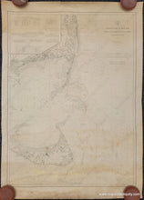
Antique nautical sailing chart of Nantucket and Chatham Massachusetts from 1910 with depths and navigation information uncolored. Maps of Antiquity
1910 - Nantucket Sound and Eastern Approaches Massachusetts - Antique Chart
  • Load image into Gallery viewer, Antique nautical sailing chart of Nantucket and Chatham Massachusetts from 1910 with depths and navigation information uncolored. Maps of Antiquity
  • Load image into Gallery viewer, 1910 - Nantucket Sound and Eastern Approaches Massachusetts - Antique Chart
  • Load image into Gallery viewer, 1910 - Nantucket Sound and Eastern Approaches Massachusetts - Antique Chart

1910 - Nantucket Sound and Eastern Approaches Massachusetts - Antique Chart

Regular price
$575.00
Sale price
$575.00
Regular price
Sold out
Unit price
per 
Shipping calculated at checkout.

Item number: NAU407

Genuine Antique Nautical Chart

1910

Maker: U.S. Coast Survey.


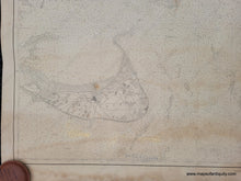
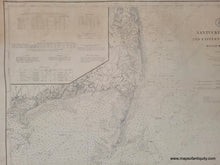
Black and white antique working nautical chart of the waters surrounding Monomoy, Chatham and Nantucket Sound. This is a working chart produced by the U.S. Coast Survey, originally published in 1866 and corrected to 1910. Includes bathymetric data, as well as information on lights, light vessels, buoys, life saving stations, weather signal stations, and tides. With coastal detail including buildings, roads, and the railroad before it went to Chatham. It seems that although the sailing information was updated to 1910, the land information was not- by 1910 the railroad was running to Chatham. Overall in good antique condition with toning, some water stain at bottom, some wear at the edges including a tear at the top that reaches to the border line, and other minor signs of age. Measures approx. 37.5 x 27.75 inches. Priced as-is. Could be professionally restored (cleaned, deacidified, repaired) for around $350. **NOTE- this map requires extra insurance for shipping, which may increase the shipping price a small amount**

Genuine Antique Chart from 1910

Item Number: NAU407