Current hours: 10am to 5pm Monday through Saturday. 12pm to 5pm Sundays. IMPORTANT PLEASE NOTE: We have become aware that some of our photos have been stolen by other websites. Our maps are only available at our website www.mapsofantiquity.com or at our store!

Antique-Nautical-Chart-Atlantic-Coast-of-the-United-States---Cape-Canaveral-to-Havana-with-Straits-of-Florida-and-Bahama-Banks-Nautical-Charts--1886/1886-Hydrographic-Office-of-the-US-Navy-Maps-Of-Antiquity-1800s-19th-century
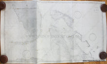
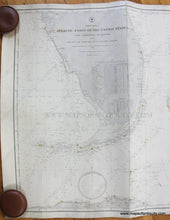
1886/1888 - Atlantic Coast of the United States - Cape Canaveral to Havana, with Straits of Florida and Bahama Banks - Antique Chart
  • Load image into Gallery viewer, Antique-Nautical-Chart-Atlantic-Coast-of-the-United-States---Cape-Canaveral-to-Havana-with-Straits-of-Florida-and-Bahama-Banks-Nautical-Charts--1886/1886-Hydrographic-Office-of-the-US-Navy-Maps-Of-Antiquity-1800s-19th-century
  • Load image into Gallery viewer, 1886/1888 - Atlantic Coast of the United States - Cape Canaveral to Havana, with Straits of Florida and Bahama Banks - Antique Chart
  • Load image into Gallery viewer, 1886/1888 - Atlantic Coast of the United States - Cape Canaveral to Havana, with Straits of Florida and Bahama Banks - Antique Chart
  • Load image into Gallery viewer, 1886/1888 - Atlantic Coast of the United States - Cape Canaveral to Havana, with Straits of Florida and Bahama Banks - Antique Chart

1886/1888 - Atlantic Coast of the United States - Cape Canaveral to Havana, with Straits of Florida and Bahama Banks - Antique Chart

Regular price
$1,500.00
Sale price
$1,500.00
Regular price
Sold out
Unit price
per 
Shipping calculated at checkout.

Item number: NAU377
Genuine Antique Nautical Chart

1886/1888

Maker: Hydrographic Office of the US Navy.

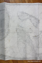
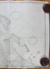
Antique nautical chart of part of Florida with part of the Bahamas, by the Hydrographic Office of the US Navy, compiled from the latest US Coast and British Admiralty Surveys, 1886 and updated to 1888. This chart has fabulous representations of the southern tip of Florida, the Florida Keys, and many Bahama Islands including Andros, Great Bahama, Great Abaco, the Berry Islands, New Providence, Cat Island, Eleuthera, Exuma, Long Island, San Salvador or Watlings Island, and more. Shows locations of lighthouses as red points with yellow surround and a previous owner of the chart noted in pencil the extent of some lighthouses' visibility at sea. Depths in fathoms, types of sand at ocean floor indicated with abreviation key, a list of lighthouses indicates their distinct features. Backed with linen. Fair to good restored condition with some mild stains, some pencil marks, and vertical creases that could be flattened by mounting. Measures approx. 27 x 46 inches to the paper edges. **NOTE- because this map requires extra insurance for shipping, an additional charge will appear on your card after your original purchase. If you would like to know what that charge will be, please contact us.**

Item Number: NAU377