Current hours: 10am to 5pm Monday through Saturday. Closed on Sundays. IMPORTANT PLEASE NOTE: We have become aware that some of our photos have been stolen by other websites. Our maps are only available at our website www.mapsofantiquity.com or at our store!

Genuine-Antique-Chart-The-Coast-of-the-United-States-of-North-America-from-New-York-to-St-Augustine-1844-Blunt-Maps-Of-Antiquity
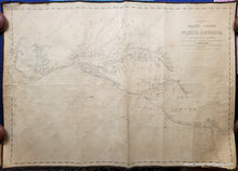
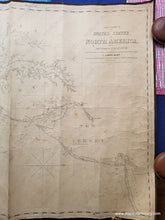
1844 - The Coast of the United States of North America, from New York to St. Augustine - Antique Map
  • Load image into Gallery viewer, Genuine-Antique-Chart-The-Coast-of-the-United-States-of-North-America-from-New-York-to-St-Augustine-1844-Blunt-Maps-Of-Antiquity
  • Load image into Gallery viewer, 1844 - The Coast of the United States of North America, from New York to St. Augustine - Antique Map
  • Load image into Gallery viewer, 1844 - The Coast of the United States of North America, from New York to St. Augustine - Antique Map
  • Load image into Gallery viewer, 1844 - The Coast of the United States of North America, from New York to St. Augustine - Antique Map
  • Load image into Gallery viewer, 1844 - The Coast of the United States of North America, from New York to St. Augustine - Antique Map
  • Load image into Gallery viewer, 1844 - The Coast of the United States of North America, from New York to St. Augustine - Antique Map
  • Load image into Gallery viewer, 1844 - The Coast of the United States of North America, from New York to St. Augustine - Antique Map

1844 - The Coast of the United States of North America, from New York to St. Augustine - Antique Map

Regular price
$1,200.00
Sale price
$1,200.00
Regular price
Sold out
Unit price
per 
Shipping calculated at checkout.

Item number: CSMT130
Genuine Antique Chart

1844

Maker: Blunt

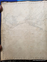
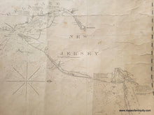
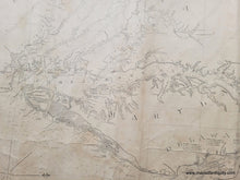
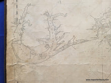
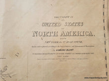
Antique blueback nautical chart of the US coast in the Mid-Atlantic area, published by E. & G. W. Blunt. First published in 1827, this chart includes additions up to 1844. A handsome chart shows the coast of New York, New Jersey, Delaware, Maryland, Virginia, and part of North Carolina to Cape Hatteras. It is oriented with north to the right. Includes water depths, cities such as Cape May NJ, Philadelphia PA, Baltimore MD, Washington DC, Richmond and Norfolk VA, and Washington NC. With Pamlico (spelled Pamtico) Sound, Albemarle Sound, Chesapeake Bay, and Delaware Bay. Fair to good antique condition with signs of age typical for a working chart that was used at sea. This chart has toning, small stains, and some edge wear including a tear at the upper left and lower right. Vertical crease at center. Could be restored for an additional cost. Measures approx. 26 x 37 inches to the neatline. **NOTE- because this map requires extra insurance for shipping, which is why the shipping cost is higher than other items. If you would like it shipped without insurance, please contact us.**

Item Number: CSMT130