Current hours: 10am to 5pm Monday through Saturday. 12pm to 5pm Sundays. IMPORTANT PLEASE NOTE: We have become aware that some of our photos have been stolen by other websites. Our maps are only available at our website www.mapsofantiquity.com or at our store!

Genuine-Antique-Chart-Coast-Chart-No-83-Apalachicola-Bay-to-Cape-San-Blas-Florida-1883-US-Coast-and-Geodetic-Survey-Maps-Of-Antiquity
  • Load image into Gallery viewer, Genuine-Antique-Chart-Coast-Chart-No-83-Apalachicola-Bay-to-Cape-San-Blas-Florida-1883-US-Coast-and-Geodetic-Survey-Maps-Of-Antiquity
  • Load image into Gallery viewer, Genuine-Antique-Chart-Coast-Chart-No-83-Apalachicola-Bay-to-Cape-San-Blas-Florida-1883-US-Coast-and-Geodetic-Survey-Maps-Of-Antiquity
  • Load image into Gallery viewer, Genuine-Antique-Chart-Coast-Chart-No-83-Apalachicola-Bay-to-Cape-San-Blas-Florida-1883-US-Coast-and-Geodetic-Survey-Maps-Of-Antiquity

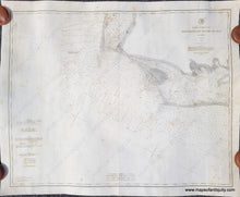
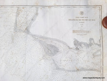
1883 - Coast Chart No. 83, Apalachicola Bay to Cape San Blas, Florida - Antique Map

Regular price
$350.00
Sale price
$350.00
Regular price
Sold out
Unit price
per 
Shipping calculated at checkout.

Item number: NAU442
Genuine Antique Chart

1883

Maker: US Coast and Geodetic Survey

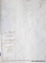
Antique chart of part of Florida, from Apalachicola Bay to Cape San Blas, published by the US Coast & Geodetic Survey in 1883. With Light houses, buoys, tides, and soundings. This chart appears to have been restored and backed with fabric by a previous owner. Good condition with foxing throughout. There is a crack along the center and some others at the sides that were repaired when the chart was backed, but are still visible. Measures approx. 32.25 x 40.25 inches to the neatline.

Item Number: NAU442