Item number: NAU537
Genuine Vintage Reproduction Chart
1960 circa
Maker: Des Barres
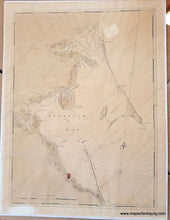
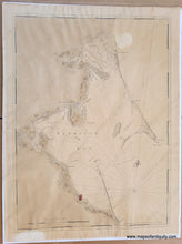
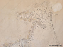
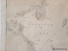
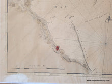
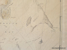
Nautical chart of Plymouth Harbor, Massachusetts. This is probably an old reproduction, but it is quite odd and has a feel of antique authenticity. It is backed on laid paper but the paper the image is printed on does not appear to be laid paper, and it has no plate mark. We are aware that many of Des Barres' charts were reproduced in the 1960s, but they typically have a note at bottom outside the neatline indicating that it is a reproduction- this chart has no such note. This chart also has a subtle break in the border on the right side where the lines do not match up.
Shows Plymouth Bay and Harbor, with the village of Plymouth, as well as areas that we now know as Duxbury, Kingston, Saquish, Gurnet, and more. Includes some information about buildings and properties. Colonel Joseph Frederick Wallet Des Barres (1721 - 1824) was a cartographer who served in the Seven Years' War. He also created the monumental four-volume Atlantic Neptune, which was the most important collection of maps, charts, and views of North America published in the eighteenth century. Des Barres's superb atlas contains the coasts of Nova Scotia (volumes 1 and 2), the coasts and harbors of the Gulf and River of St. Lawrence, and the Atlantic coast of North America from New York to Mexico (volume 3) and New England (Volume 4). This chart was included in the fourth volume. "Nautical charting took an unprecedented leap toward greater precision and graphic sophistication with the publication of Des Barres's Atlantic Neptune... The Neptune provided the first generally accurate charts of many areas, and it was relied upon well into the nineteenth century. Des Barres also standardized many of the symbols, such as for navigational hazards, that are found on nautical charts to this day... Not only were Des Barres's charts technically superior to earlier works, but they were also objects of fine printing and possessed an artistry that transcended their utilitarian purpose." (Paul E. Cohen and Robert T. Augustyn, Manhattan in Maps 1527-1995, New York, 1997, pp.66-69) The Atlantic Neptune was issued chaotically over several years, making the charts difficult to date. "12" engraved in small oval in upper right corner of the border. Fair to good antique condition; whole but overall toning with some areas of uneven toning including lighter sections. Some wrinkles. Some minor edges wear and a small tear at top right and another at lower left. With original hand-coloring. Could be restored to even the toning but might lose its original coloring. Measures approx. 25.75 x 19 inches to the neatline. Price is based on condition.
Item Number: NAU537


