Current hours: 10am to 5pm Monday through Saturday. 12pm to 5pm Sundays. IMPORTANT PLEASE NOTE: We have become aware that some of our photos have been stolen by other websites. Our maps are only available at our website www.mapsofantiquity.com or at our store!

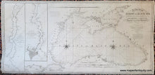
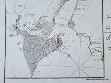
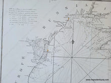
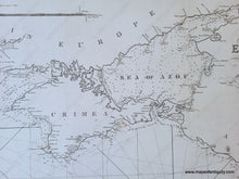
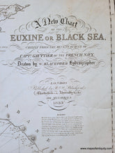
Antique black and white chart of the Black Sea with Crimea and Constantinople. 
Genuine-Antique-Chart-A-New-Chart-of-the-Euxine-or-Black-Sea-Chiefly-from-the-Recent-Survey-of-Capt-Gauttier-of-the-French-Navy-1833-R---W-Blachford-Maps-Of-Antiquity
Antique black and white chart of the Black Sea with Crimea and Constantinople.
  • Load image into Gallery viewer, Antique black and white chart of the Black Sea with Crimea and Constantinople. 
Genuine-Antique-Chart-A-New-Chart-of-the-Euxine-or-Black-Sea-Chiefly-from-the-Recent-Survey-of-Capt-Gauttier-of-the-French-Navy-1833-R---W-Blachford-Maps-Of-Antiquity
  • Load image into Gallery viewer, Antique black and white chart of the Black Sea with Crimea and Constantinople.
  • Load image into Gallery viewer, Antique black and white chart of the Black Sea with Crimea and Constantinople.
  • Load image into Gallery viewer, Antique black and white chart of the Black Sea with Crimea and Constantinople.
  • Load image into Gallery viewer, Antique black and white chart of the Black Sea with Crimea and Constantinople.
  • Load image into Gallery viewer, Antique black and white chart of the Black Sea with Crimea and Constantinople.
  • Load image into Gallery viewer, Antique black and white chart of the Black Sea with Crimea and Constantinople.
  • Load image into Gallery viewer, Antique black and white chart of the Black Sea with Crimea and Constantinople.

1833 - A New Chart of the Euxine or Black Sea, Chiefly from the Recent Survey of Capt. Gauttier of the French Navy - Antique Map

Regular price
$1,500.00
Sale price
$1,500.00
Regular price
Sold out
Unit price
per 
Shipping calculated at checkout.

Item number: NAU544

Genuine Antique Chart

1833

Maker: R. & W. Blachford


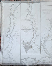
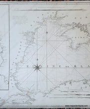
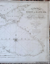
Antique nautical chart of the Black Sea published in 1833 by Robert and William Blachford. This chart was drawn by William Blachford using the latest surveys from the French Navy. Inset maps on the left side show Hellespont or the Dardanells / Strait of Gallipoli and the channel of Constantinople. This fascinating chart shows the route of the survey ship with water depths, coastal towns and cities, some topography, four recognition profiles, two compass roses with rhumb lines, and a handsome Spencerian title. Includes Crimea, the Sea of Azov, mouths of the Danube, the Sea of Marmara, and a bit of the Aegean Sea. Very good restored condition. This chart has been cleaned, deacidified, and rebacked with blue paper. Still shows signs of age with some repaired tears and separations, some minor small stains and folds. Measures approx. 25.25 x 52.5 inches to the neatline. NOTE- this map requires extra insurance for shipping, which increases the cost of shipping.  

Robert Blachford was an Irish chartmaker who began publishing charts in the early 1800s. In the 1820s he partnered with William Blachford, possibly a relative. Both Robert and William retired around 1835 when they passed the business to Michael Blachford. Michael partnered with, and was later bought out by, James Imray, who became one of the most successful chartmakers of the 19th century.

Genuine Antique Chart from 1833

Item Number: NAU544