1859
Maker: USCS
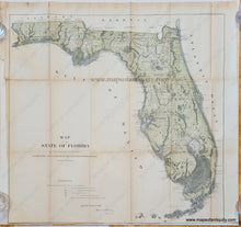
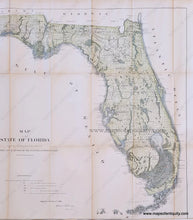
Hand colored antique survey map of Florida, made to accompany the report of the Surveyor General for 1859. This detailed map shows the progress of surveying the state of Florida, including a good understanding of the Everglades, the coast, and the Florida Keys. For an early map, it has a lot of detail, yet it is missing many features including Tampa, Sarasota, St. Petersburg, and Fort Lauderdale appears as an actual fort. The railroads are just beginning to traverse into florida primarily in the north, and are along the panhandle as far as Tallahassee and in the west going south to Pensacola. A very interesting and unusual map of Florida. Good to very good condition with folds as issued, some toning and wear along the folds with some small separations at the fold intersections. Tight margins on two sides. Measures approx. 23.5 x 24.25 inches to the neatline.
Item Number: SOU483


