Pickup available at 1409 MAIN ST, CHATHAM MA
Usually ready in 24 hours
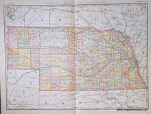
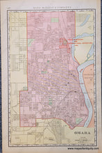
1898 - Double-sided map: Nebraska, Omaha on verso - Antique Map
-
1409 MAIN ST, CHATHAM MA
Pickup available, usually ready in 24 hours1409 Main Street
Chatham MA 02633
United States+15089451660
1898
Maker: Rand McNally
Antique map of Nebraska from Rand McNally's Indexed Atlas of the World, 1898. The large centerfold map is the state of Nebraska and on the back is a map of Omaha that includes the Trans-Mississippi and International Exposition of 1898. Original printed color. Colored by county. Shows topography, railroads, towns, cities, etc. Very good antique condition with minor signs of age. Center fold as issued. Measures approx 19 x 25.75 inches to the neatline. Omaha map measures approx. 19 x 12.5 inches.
Item Number: MWE573


