Winter hours: Tuesday - Saturday 10am to 5pm. Close Sundays and Mondays until May. We appreciate your business!

Reproduction-Antique-Map-Eldridge's-Chart-of-Long-Island-Sound-Newport-to-New-York
Eldridge's Chart of Long Island Sound, Newport to New York - Reproduction Map -
  • Load image into Gallery viewer, Reproduction-Antique-Map-Eldridge's-Chart-of-Long-Island-Sound-Newport-to-New-York
  • Load image into Gallery viewer, Eldridge's Chart of Long Island Sound, Newport to New York - Reproduction Map -
  • Load image into Gallery viewer, Eldridge's Chart of Long Island Sound, Newport to New York - Reproduction Map -
  • Load image into Gallery viewer, Eldridge's Chart of Long Island Sound, Newport to New York - Reproduction Map -
  • Load image into Gallery viewer, Eldridge's Chart of Long Island Sound, Newport to New York - Reproduction Map -

Eldridge's Chart of Long Island Sound, Newport to New York - Reproduction Map -

Regular price
$250.00
Sale price
$250.00
Regular price
Sold out
Unit price
per 
Shipping calculated at checkout.

Item number: REP336
Reproduction

Maker: Reproduction.

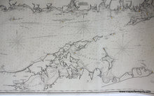
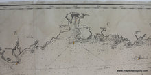
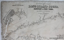
High quality black and white giclee reproduction at full size of the Long Island nautical chart by George Eldridge, published by Thaxter & Son, Boston in 1877. Great detail of eastern Long Island, north shore of Long Island and Connecticut shoreline. The original from which the image was taken was restored, some patched reconstruction where paper loss, around New York City and Block Island. Measures approx. 105w x 26.25h inches. Measured to the edges of the printed area. Paper may be larger but can be trimmed as needed.

Item Number: REP336