Winter hours: Tuesday - Saturday 10am to 5pm. Close Sundays and Mondays until May. We appreciate your business!

Reproduction-Lake-Champlain-Sheet-No-2-from-Cumberland-Head-to-Ligonier-Point---Reproduction---Reproduction-Northeast--Reproduction-Maps-Of-Antiquity
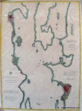
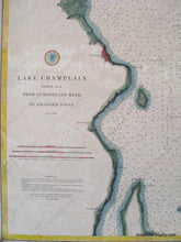
Lake Champlain Sheet No 2 from Cumberland Head to Ligonier Point - Reproduction Map -
  • Load image into Gallery viewer, Reproduction-Lake-Champlain-Sheet-No-2-from-Cumberland-Head-to-Ligonier-Point---Reproduction---Reproduction-Northeast--Reproduction-Maps-Of-Antiquity
  • Load image into Gallery viewer, Lake Champlain Sheet No 2 from Cumberland Head to Ligonier Point - Reproduction Map -

Lake Champlain Sheet No 2 from Cumberland Head to Ligonier Point - Reproduction Map -

Regular price
$50.00
Sale price
$50.00
Regular price
Sold out
Unit price
per 
Shipping calculated at checkout.

Item number: REP331
Reproduction

Maker: Reproduction.

High quality color giclee reproduction of the coast chart showing part of Lake Champlain by the US Coast Survey c. 1873. This is sheet 2 showing from Cumberland Head to Ligonier Point with towns colored red and water depth information throughout the lake. approx. 32 x 24 to the edge of the image. Measured to the edges of the printed area. Paper may be larger but can be trimmed as needed.

Item Number: REP331