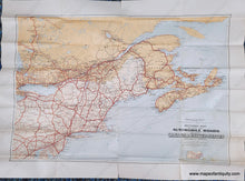
Current hours: 10am to 5pm Tuesday through Saturday. We are closed Sundays and Mondays for the Winter. IMPORTANT PLEASE NOTE: We have become aware that some of our photos have been stolen by other websites. Our maps are only available at our website www.mapsofantiquity.com or at our store!

Genuine-Antique-Map-Sectional-Map-indicating-Main-Automobile-Roads-between-Canada-United-States-Atlantic-Sheet--1928-Department-of-the-Interior-Canada-Maps-Of-Antiquity
  • Load image into Gallery viewer, Genuine-Antique-Map-Sectional-Map-indicating-Main-Automobile-Roads-between-Canada-United-States-Atlantic-Sheet--1928-Department-of-the-Interior-Canada-Maps-Of-Antiquity
  • Load image into Gallery viewer, Genuine-Antique-Map-Sectional-Map-indicating-Main-Automobile-Roads-between-Canada-United-States-Atlantic-Sheet--1928-Department-of-the-Interior-Canada-Maps-Of-Antiquity
  • Load image into Gallery viewer, Genuine-Antique-Map-Sectional-Map-indicating-Main-Automobile-Roads-between-Canada-United-States-Atlantic-Sheet--1928-Department-of-the-Interior-Canada-Maps-Of-Antiquity
  • Load image into Gallery viewer, Genuine-Antique-Map-Sectional-Map-indicating-Main-Automobile-Roads-between-Canada-United-States-Atlantic-Sheet--1928-Department-of-the-Interior-Canada-Maps-Of-Antiquity

1928 - Sectional Map indicating Main Automobile Roads between Canada & United States (Atlantic Sheet) - Antique Map

Regular price
$65.00
Sale price
$65.00
Regular price
Sold out
Unit price
per 
Shipping calculated at checkout.

Item number: NAM285
Genuine Antique Map

1928

Maker: Department of the Interior, Canada

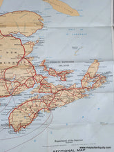
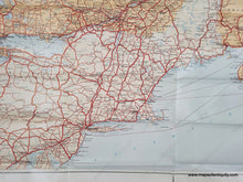
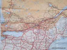
Antique road map of the Northeastern US and Eastern Canada published by the Dept of Interior, Canada, 1928. This map covers the area from Washington DC to New Brunswick and Nova Scotia with with some of the Great Lakes including Lake Ontario, the coast from New Jersey to Maine with Cape Cod, Boston, Long Island, the St Lawrence River with Montreal, Quebec, Ottawa, Toronto, and Niagara Falls. Good to very good antique condition with folds as issued, some tears along the folds that can be repaired, and some mild stains in the lower right. Measures approx. 24 x 35 inches to the neatline.

Item Number: NAM285