1893
Maker: Cram
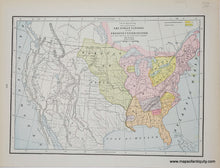
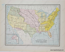
Antique double-sided page of maps. On one side is a printed color map of the United States showing the locations of Native American Indian tribes in the eastern and midwestern U.S. at the time of settlement by Europeans, by Cram, 1893. Verso map is also of the United States, showing the progression of the occupation and details of the territorial acquisitions from 1776-1891 that formed the United States, including an inset map of Alaska. Good to Very good overall antique condition with mild toning throughout, some mild soiling at the outer edges of the paper, and some image overlay/misplaced ink on the verso map side. Map of Indian Nations measures approx. 9.25" x 12.75" to the neatline. Verso Map measures approx. 9" x 12" to the neatline.
Genuine Antique Map from 1893
Item Number: USA461


