Genuine Antique Coast Chart
1889
Maker: US Coast and Geodetic Survey.
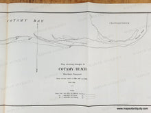
Black and white antique map comparing the coast of part of Chappaquiddick by the US Coast and Geodetic Survey, surveyed in 1886, 1887 and 1889 and published in their report of 1889. This map shows the different coast lines to document shoreline erosion and changes. Very good overall antique condition with some tiny spots and slight image transfer (aka ghosting). Measures approx. 9 x 29 inches to neatline.
Genuine Antique Map from 1889
Item Number: MAS2463


