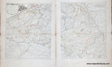
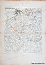
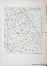
Genuine Antique Map
circa 1775
Maker: Danet
Antique two page set of maps of Belgium with Luxembourg, and parts of France, Netherlands, and Germany, from a composite atlas circa 1775. A composite atlas is an atlas made up of a selection of previously issued maps. This atlas appears to have been partly by Louis Charles Desnos and an atlas title page dated 1769 by Desnos was present. The full title translates to "MAP OF THE CATHOLIC NETHERLANDS and part of LOWER GERMANY where are located BRABANT, FLANDERS HAYNAUT, CAMBRESIS, LIMBURG, LUXEMBOURG, the Codex NAMUR: the ARCHIVES of COLOGNE and TRIER, the BISHOPRIC of LIEGE, and the DUCHY OF JULLIERS. With the surrounding territories of all these states. Based on the Memoirs of N. de Fer, Published by G. Danet, Drawn up and Engraved by Le Parmentier. In Paris on the Pont Notre Dame at the Royal Palace. With the King's Privilege, 1745." This map has original hand-coloring and shows cities, towns, villages, rivers, topographic detail, etc. Includes Koblenz, Brussels, Amiens, Cologne, Flanders, and more. Good antique condition with some minor foxing, some small tears at paper loss at the paper edges. Each sheet measures approx. 22 x 18 inches to the neatline.
Genuine Antique Map from circa 1775
Item Number: CSMT269


