Current hours: 10am to 5pm Monday through Saturday and 12-5 on Sundays. Proud to be a SMALL, LOCAL, CAPE COD BUSINESS! Maps of Antiquity is in its 38th year! Our maps are only available at our website www.mapsofantiquity.com or at our store!

Genuine-Antique-Booklet-with-Maps-Index-of-Streets-and-Plans-of-Paris-1910-Baedeker-Maps-Of-Antiquity
1910 - Index of Streets and Plans of Paris - Genuine Antique Booklet with Maps
  • Load image into Gallery viewer, Genuine-Antique-Booklet-with-Maps-Index-of-Streets-and-Plans-of-Paris-1910-Baedeker-Maps-Of-Antiquity
  • Load image into Gallery viewer, 1910 - Index of Streets and Plans of Paris - Genuine Antique Booklet with Maps
  • Load image into Gallery viewer, 1910 - Index of Streets and Plans of Paris - Genuine Antique Booklet with Maps
  • Load image into Gallery viewer, 1910 - Index of Streets and Plans of Paris - Genuine Antique Booklet with Maps
  • Load image into Gallery viewer, 1910 - Index of Streets and Plans of Paris - Genuine Antique Booklet with Maps
  • Load image into Gallery viewer, 1910 - Index of Streets and Plans of Paris - Genuine Antique Booklet with Maps
  • Load image into Gallery viewer, 1910 - Index of Streets and Plans of Paris - Genuine Antique Booklet with Maps
  • Load image into Gallery viewer, 1910 - Index of Streets and Plans of Paris - Genuine Antique Booklet with Maps
  • Load image into Gallery viewer, 1910 - Index of Streets and Plans of Paris - Genuine Antique Booklet with Maps
  • Load image into Gallery viewer, 1910 - Index of Streets and Plans of Paris - Genuine Antique Booklet with Maps

1910 - Index of Streets and Plans of Paris - Genuine Antique Booklet with Maps

Regular price
$85.00
Sale price
$85.00
Regular price
Sold out
Unit price
per 
Shipping calculated at checkout.

Item number: TOW824

Genuine Antique Booklet with Maps

1910

Maker: Baedeker


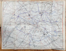
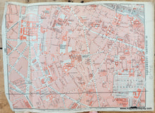
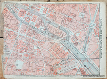
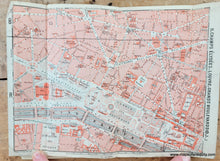
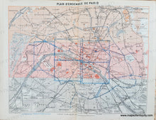
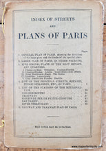
Antique tourism booklet of Paris with maps and visitor information, published by Karl Baedeker in 1910. Includes a general plan of Paris, a "Large Plan of Paris, in three sections," five smaller plans of specific areas, and a map of the omnibus and tram lines. The three sections of the large plan are printed in different colored ink to indicate which portion of the city it is, and these colors correspond to the general plan. This was published after the Eiffel Tower was built. Excellent detail and vibrant original printed color. The maps could be removed from the booklet and framed. The three sections of the large map could be joined to make one large map. The three sections of the large plan are folded and have some wear along the folds, and one of the five smaller plans has notable wear at the edge. The booklet measures approx. 6.25 x 4.5 inches. The general plan measures approx. 6.25 x 8 inches. The three sections of the large map measure approx. 6.25 x 23.5 inches each (joined they would make a map about 18.75 x 23.5 inches), the smaller plans are about 8.5 x 6.25 inches, and the Omnibus map is about 11 x 13.5 inches (all measurements to the paper edges).

Genuine Antique Booklet with Maps from 1910

Item Number: TOW824