1889
Maker: US Coast and Geodetic Survey
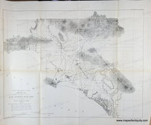
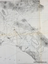
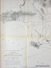
Antique map of the area around Los Angeles published by the U.S. Coast and Geodetic Survey in 1889. This map includes Santa Ana, Anaheim, Long Beach, Malibu, and many other areas that have been developed significantly, although on this map they are either much smaller or not yet in existence. This map is a triangulation map- Triangulation is the process of determining the location of a point by measuring only angles to it from known points at either end of a fixed baseline. This map shows the new baseline and connecting triangulation in solid lines, the old base and connections in broken lines, and railroads in hatched lines. Very good antique condition with mild overall toning, slight wear at the paper edges, some wrinkles and wear at the fold intersections. Measures approx. 21.5 x 28 inches to the neatline.
Genuine Antique Map from 1889
Item Number: WES550


