Pickup available at 1409 MAIN ST, CHATHAM MA
Usually ready in 24 hours
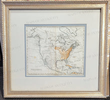
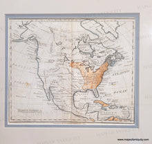
1814 - North America - Antique Map (Framed)
-
1409 MAIN ST, CHATHAM MA
Pickup available, usually ready in 24 hours1409 Main Street
Chatham MA 02633
United States+15089451660
Item number: NAM290
Genuine Antique Map
c. 1814
Maker: Potter
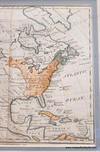
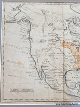
Antique Map of North America, by Paraclete Potter, 1814 and engraved by J.D. Stout. From A Geography for the Use of Schools, Illustrated with an Atlas of Seven Maps, bound separately. Includes New Albion, also known as Nova Albion, was the name of all North America north of Mexico, from "sea to sea," claimed by Sir Francis Drake for England in 1579. The extent of New Albion and the location of Drake's port have long been debated by historians, with most believing that he came ashore in the Bay Area on the coast of northern California. Also includes a rough sketch of Alaska, the Stony Mountains in Canada but no sign of the Rocky Mountains, some large lakes and rivers in the west that hint at the possibility of a navigable water route across the continent. St Louis is on this map with its previous name: New Madrid, Santa Fe is also on the map, as is Texas and East and West Florida. Center fold as issued. Good overall antique condition, with toning, some minor stains and some later coloring. Framed - mats appear to be archival. Measures approx. 7.75 x 9.5 inches to the neatlines. Total frame size is approx. 15 x 17 inches. Could be removed from frame and shipped unframed, which would reduce the shipping cost.
Genuine Antique Map from 1814
Model Number: NAM290


