Pickup available at 1409 MAIN ST, CHATHAM MA
Usually ready in 24 hours
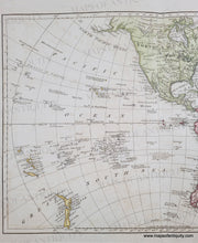
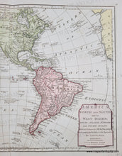
1786 - America North and South and the West Indies; with the Atlantic, Aethiopic and Pacific Oceans… - Antique Map
-
1409 MAIN ST, CHATHAM MA
Pickup available, usually ready in 24 hours1409 Main Street
Chatham MA 02633
United States+15089451660
1786
Maker: Dunn / Sayer
Antique map of the Western Hemisphere by Samuel Dunn, printed for Robert Sayer, 1786. Includes the new United States. Florida was still under Spanish control. The River of the West is shown, and Quivira, the legendary city of gold, is included. This map has a reasonably good shape of Alaska and the West Coast and indicates Hawaii, or "Owhyhee where Capt. Cook was killed." Also has New Zealand and part of Africa. Antarctica is largely unknown but there are two notations of sightings of land. Good to very good antique condition with mild image transfer, some tiny spots, and a separation along the center fold that goes slightly into the map. Measures approx. 12 x 17.25 inches to the neatline.
Genuine Antique Map from 1786
Item Number: CSMT174


