Genuine Antique Printed Color Map
c. 1895
Maker: Rand McNally.
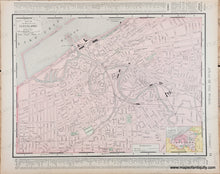
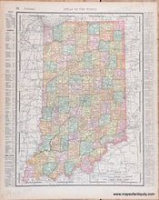
Antique printed color map of Cleveland, Ohio (Recto.) Cleveland map includes names of major streets, parks, cemeteries, etc. Inset map of the greater Cleveland area. Text in margins is a key to the points of interest and streets. On Verso: Map of Indiana. Indiana map is colored by county and shows cities, towns, railroads, etc. Text in margins is a key to the counties, cities, and populations. Very good antique condition with minor toning throughout, which is darker along the outer edges of the paper, and a crease at one corner of the page. By Rand McNally, 1895. Recto map (Cleveland, OH) measures approximately 9.25" x 12.5" (H x W) to the neatline. Verso map (Indiana) measures approx. 12.25" x 9" to the neatline.
Genuine Antique Map from 1895
Item Number: TOW605


