1898
Maker: Cram.
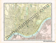
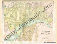
Antique printed color center fold map of Pittsburgh and Allegheny City, PA (Recto). Verso: (Two Maps) A map of Cincinnati and a map of Richmond and Manchester, Virginia. Map of Cincinnati includes a reference to figures on the map. Map of Richmond and Manchester includes indications for "steam railroads" and "horse railroads." Very good condition with some slight overall toning. Paper binding strip on the Ridmond map side (not shown in this photo). By Cram, in Cram's Unrivaled Family Atlas of the World, 1898. Recto Map (Pittsburgh and Allegheny City) measures approximately 12.5" x 18.25" to the neatline. Map of Cincinnati measures approx. 9" x 11.25" to the neatline. Map of Richmond and Manchester measures approx. 10" x 12.5" to the neatline. If you would like to purchase the Richmond or Cincinnati maps separate from the others, please contact us.
Item Number: MAT184


