Current hours: 10am to 5pm Monday through Saturday. Closed on Sundays. IMPORTANT PLEASE NOTE: We have become aware that some of our photos have been stolen by other websites. Our maps are only available at our website www.mapsofantiquity.com or at our store!

Antique-Coastal-Chart-Reconnaissance-of-the-Western-Coast-of-the-United-States-Middle-Sheet-from-San-Francisco-to-Umpquah-River.--United-States-West-1854-U.S.C.S.-Maps-Of-Antiquity
1854 - Reconnaissance of the Western Coast of the United States, Middle Sheet, from San Francisco to Umpquah River. - Antique Report Chart
  • Load image into Gallery viewer, Antique-Coastal-Chart-Reconnaissance-of-the-Western-Coast-of-the-United-States-Middle-Sheet-from-San-Francisco-to-Umpquah-River.--United-States-West-1854-U.S.C.S.-Maps-Of-Antiquity
  • Load image into Gallery viewer, 1854 - Reconnaissance of the Western Coast of the United States, Middle Sheet, from San Francisco to Umpquah River. - Antique Report Chart
  • Load image into Gallery viewer, 1854 - Reconnaissance of the Western Coast of the United States, Middle Sheet, from San Francisco to Umpquah River. - Antique Report Chart
  • Load image into Gallery viewer, 1854 - Reconnaissance of the Western Coast of the United States, Middle Sheet, from San Francisco to Umpquah River. - Antique Report Chart
  • Load image into Gallery viewer, 1854 - Reconnaissance of the Western Coast of the United States, Middle Sheet, from San Francisco to Umpquah River. - Antique Report Chart

1854 - Reconnaissance of the Western Coast of the United States, Middle Sheet, from San Francisco to Umpquah River. - Antique Report Chart

Regular price
$250.00
Sale price
$250.00
Regular price
Sold out
Unit price
per 
Shipping calculated at checkout.

Item number: WES077BW
Genuine Antique Coast Report Chart

1854

Maker: U.S.C.S..


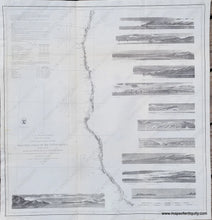
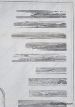
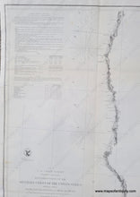
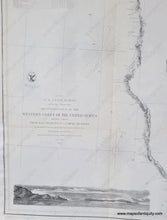
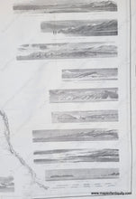
Antique Coast Survey Report Chart of the Western Coast of the United States, including Northern California and Southern Oregon. The twelve views are recognition profiles that would be useful to recognize the land from a ship. These include Cape Arago, Rogue's River, Point Saint George, Red Bluff, Cape Mendocino, Entrance to San Francisco Bay, Point Reyes, and many more. Restored-- cleaned and backed with light tissue. Very good overall restored condition, with a slight waviness to the paper. Measures approx. 24.75 x 22.5 inches to the neatline.


Item Number: WES077BW