Current hours: 10am to 5pm Tuesday through Saturday. We are closed Sundays and Mondays for the Winter. IMPORTANT PLEASE NOTE: We have become aware that some of our photos have been stolen by other websites. Our maps are only available at our website www.mapsofantiquity.com or at our store!

Antique-Black-and-White-Nautical-Chart-Chart-No.-136-West-Coast-of-North-America-San-Francisco-to-Queen-Charlotte-Island-1888-1889-Imray-&-Son-US-West-Charts-1800s-19th-century-Maps-of-Antiquity
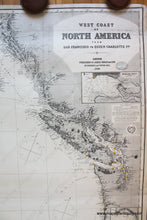
1888 / 1889 - Chart No. 136 West Coast Of North America San Francisco To Queen Charlotte Island
  • Load image into Gallery viewer, Antique-Black-and-White-Nautical-Chart-Chart-No.-136-West-Coast-of-North-America-San-Francisco-to-Queen-Charlotte-Island-1888-1889-Imray-&-Son-US-West-Charts-1800s-19th-century-Maps-of-Antiquity
  • Load image into Gallery viewer, 1888 / 1889 - Chart No. 136 West Coast Of North America San Francisco To Queen Charlotte Island
  • Load image into Gallery viewer, 1888 / 1889 - Chart No. 136 West Coast Of North America San Francisco To Queen Charlotte Island
  • Load image into Gallery viewer, 1888 / 1889 - Chart No. 136 West Coast Of North America San Francisco To Queen Charlotte Island
  • Load image into Gallery viewer, 1888 / 1889 - Chart No. 136 West Coast Of North America San Francisco To Queen Charlotte Island

1888 / 1889 - Chart No. 136 West Coast of North America, San Francisco to Queen Charlotte Island - Antique Chart

Regular price
$850.00
Sale price
$850.00
Regular price
Sold out
Unit price
per 
Shipping calculated at checkout.

Item number: NAU360
Genuine Antique Nautical Chart

1888 / 1889

Maker: Imray & Son.

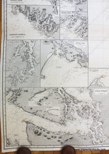
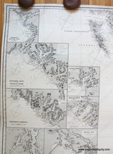
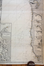
Antique uncolored nautical chart showing the coastline of Northern California to Haida Gwaii in Canada, including Vancouver, and the coasts of Washington and Oregon etc. With 16 inset maps: Fuca Straight, Royal Bay (Victoria), San Francisco, Vancouver Island, and more. Published in 1888 and corrected to 1889. This chart is comprised of 2 joined charts. It is in very good restored condition. This chart has been archivally cleaned, deacidified, and rebacked. Some signs of age are still present. Measures approximately 50 x 39.75 inches (H x W) overall. **NOTE- because this map requires extra insurance for shipping, an additional charge will appear on your card after your original purchase. If you would like to know what that charge will be, please contact us.**

Item Number: NAU360