Item number: EUR3090
Genuine Antique Map
1880
Maker: Jean-Charles Adolphe Alphand
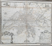
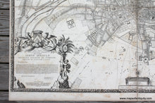
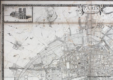
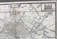
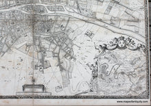
Antique 19th century facsimile of a rare map of Paris from 1672 by Jouvin de Rochefort printed by Charles Chardon. This map was published in Histoire Generale de Paris, Atlas des Anciens Plans de Paris, 1880. This atlas was produced as a folio with the maps each folded within the cover and published under the direction of Jean-Charles Adolphe Alphand (1817-1891), a French civil engineer who is known for his work to beautify Paris. He is considered the father of green spaces in Paris. This large and impressive map features illustrations of Notre Dame Cathedral and the Hotel de Ville in the upper corners, a map of the vicinity of Paris in the lower right, and a dedication to Simon Arnauld, a prominent diplomat and ambassador to Sweden. This map shows the rapidly expanding city. The Ile Louviers is shown- it is a former island in the Seine in the centre of Paris, just upstream of the present Ile Saint-Louis and of a similar size. Never built up, it was connected with the north bank of the river in 1843. In modern Paris the former island lies between the quai Henri IV and the boulevard Morland.
A much earlier Arc de Triomphe is shown on the map, on the north east side of the city. This Arc de Triomphe was not included on the 1697 map of the city. The space that is now the Place de la Nation first emerged on 26 August 1660, on the occasion of the ceremonial entrance of Louis XIV and his new wife Maria Theresa, following their wedding in Saint-Jean-de-Luz on 9 June 1660. A throne was erected on that spot, which was subsequently known as the Place du Trône ("Throne Square"). The project of a massive, four-pillared triumphal arch on the Place du Trône would mark the culmination of a program of reforms and remodeling promoted by Jean-Baptiste Colbert. A design by Claude Perrault was selected, and the arch's foundations and lower structures were erected in high-quality stone in the 1670s, but the project was abandoned around 1680, possibly for lack of funds. the unfinished structures were demolished in 1716, just after the death of Louis XIV.
This map is printed on four large sheets plus two partial sheets that have been backed on cloth to join. Fair to good antique condition with some foxing and light stains that do not detract from the enjoyment of the map but rather improve its antique appearance. Measures approx. 43 x 53 inches to the outer edge of the decorative border.
Item Number: EUR3090


