Pickup available at 1409 MAIN ST, CHATHAM MA
Usually ready in 24 hours
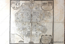
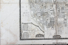
1880 - Paris de 1670 a 1676 - Plan de Paris - Antique Map
-
1409 MAIN ST, CHATHAM MA
Pickup available, usually ready in 24 hours1409 Main Street
Chatham MA 02633
United States+15089451660
1880
Maker: Jean-Charles Adolphe Alphand
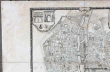
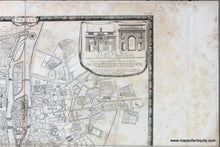
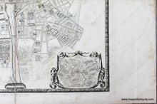
Antique 19th century facsimile of a rare map of Paris from 1676 by Bullet, Blondel, and Jaillot. This map was published in Histoire Generale de Paris, Atlas des Anciens Plans de Paris, 1880. This atlas was produced as a folio with the maps each folded within the cover and published under the direction of Jean-Charles Adolphe Alphand (1817-1891), a French civil engineer who is known for his work to beautify Paris. He is considered the father of green spaces in Paris. The original map was commissioned by King Louis XIV and created by Bullet, Blondel, and Jaillot and it took years to survey and map the city. It was issued in 1676. This map covers the area from the Bastille to the Jardin des Tuileries, and Montmartre to l'Observatoire and includes the Ile de la Cite, with Notre Dame, the Louvre, and more. Upper corners show the four great gates of Paris, the lower left has a map of the city's waterworks and fountains, and lower right shows the environs around the city. This map is printed on four large sheets that have been backed on cloth to join. Fair to good antique condition with some foxing and light stains that do not detract from the enjoyment of the map but rather improve its antique appearance. Measures approx. 35 x 35.25 inches to the outer edge of the decorative border.
Item Number: EUR3091


