Pickup available at 1409 MAIN ST, CHATHAM MA
Usually ready in 24 hours
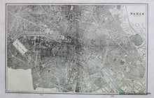
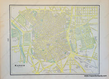
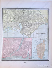
1900 - Double-sided page of maps: Paris (France), Marseilles, Nice, Corsica, and Madrid, Spain - Antique Map
-
1409 MAIN ST, CHATHAM MA
Pickup available, usually ready in 24 hours1409 Main Street
Chatham MA 02633
United States+15089451660
1900
Maker: Cram.
Antique printed color double-sided sheet of Paris, France (Recto- Pages 238-239). Verso: On Page 237- A map of Marseilles, a map of Nice, and a map of Corsica.(Any of these maps can be separated, if desired) On page 240- A map of Madrid, Spain. All of the maps label streets, bodies of water, and some points of interest. Very good condition with some slight toning/brown spots and some small tears at the edges of the pages. By Cram, in Cram's Universal Atlas Geographical, Astronomical and Historical, 1900. Recto map (Paris, France) measures approximately 11.75" x 18.5" to the neatline. Map of Marseilles, France measures approx. 6.25" x 10" to the neatline. Map of Nice, France measures approx. 4.75" x 6.25" to the neatline. Map of Corsica measures approx. 4.75" x 3.5" to the neatline. Map of Madrid, Spain measures approx. 9.25" x 12" to the neatline. If you would like to purchase any of these maps separate from the others, please contact us.
Item Number: EUR1897


