1890
Maker: Cram
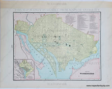
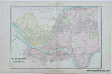
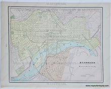
Antique printed color double-sided sheet, with a centerfold map of Pittsburgh and Allegheny City (now Pittsburgh's North Side.) Verso: On one side is a map of Richmond and Manchester Virginia. On the other side is a map of Washington D.C. Includes inset map showing the District of Columbia. Also includes a reference of the prominent buildings, churches, theatres, and hotels of the time. Good condition with some toning at the edges. By Cram, in The Standard Atlas and Gazetteer of The World, 1900. Measurements of Map of Pittsburgh and Allegheny City: Approx. 12.5" x 18.25" to the neat line. Measurements of Richmond Map: Approx. 9" x 11.25" to the neat line. Measurements of Washington D.C. Map: Approx. 8.75" x 11.25" to the neat line. If you would like to purchase the Richmond map separately from the others, please contact us.
Item Number: MAT174


