1845
Maker: Miner / Wagner & McGuigan
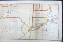
Antique map of the northeast United States, from the History of Wyoming, in a series of letters, from Charles Miner, to his son William Penn Miner, Esq, 1845. Lith. of Wagner & McGuigan. In this case, Wyoming refers to Wyoming Valley of Pennsylvania, i.e. the Wilkes-Barre, Scranton area, PA. This map shows all of Pennsylvania, Connecticut, Rhode Island, Massachusetts, and parts of the surrounding states. Connecticut claimed all of the state between the 41 and 42 parallels extending into Ohio. Includes a nice representation of the Fingerlakes Region on New York. This is a map that is rarely seen on the market. Good restored condition, with signs of age including mild staining, repaired tears, some paper loss. This map was rebacked with extended margins. Measures approx. 8.25 x 21.5 inches to the neatline.
Item Number: USA402


