Current hours: 10am to 5pm Monday through Saturday. 12pm to 5pm Sundays. IMPORTANT PLEASE NOTE: We have become aware that some of our photos have been stolen by other websites. Our maps are only available at our website www.mapsofantiquity.com or at our store!

1928 - Boston Ancient And Modern In Picture Story Antique Pictorial Map (Framed) Genuine
  • Load image into Gallery viewer, 1928 - Boston Ancient And Modern In Picture Story Antique Pictorial Map (Framed) Genuine
  • Load image into Gallery viewer, 1928 - Boston Ancient And Modern In Picture Story Antique Pictorial Map (Framed) Genuine
  • Load image into Gallery viewer, 1928 - Boston Ancient And Modern In Picture Story Antique Pictorial Map (Framed) Genuine
  • Load image into Gallery viewer, 1928 - Boston Ancient And Modern In Picture Story Antique Pictorial Map (Framed) Genuine
  • Load image into Gallery viewer, 1928 - Boston Ancient And Modern In Picture Story Antique Pictorial Map (Framed) Genuine
  • Load image into Gallery viewer, 1928 - Boston Ancient And Modern In Picture Story Antique Pictorial Map (Framed) Genuine
  • Load image into Gallery viewer, 1928 - Boston Ancient And Modern In Picture Story Antique Pictorial Map (Framed) Genuine

1928 - Boston, Ancient and Modern, In Picture and Story - Antique Pictorial Map (Framed)

Regular price
$350.00
Sale price
$350.00
Regular price
Sold out
Unit price
per 
Shipping calculated at checkout.

Item number: CSMT168

Genuine Antique Printed Color Pictorial Map

1928

Maker: Chisholm / Fagan.

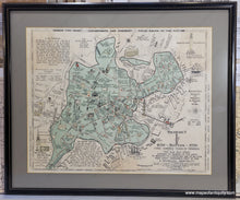
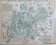
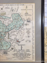
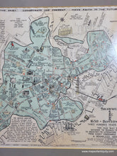
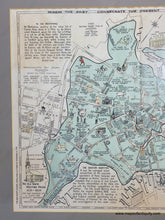
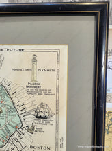
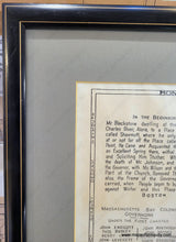
Antique printed color map of the Boston area, drawn by Ivan Chisholm. This map is the first edition of a beloved pictorial map of Boston, which contrasts the city as it was in 1630 with the city as it was in 1930.  It was drawn by Ivan A. Chisholm and arranged an edited by James O. Fagan, copyrighted in 1928 by the same. This map is full of fascinating history and accompanying illustrations. The map was apparently created in celebration of Boston's 300th anniversary (tercentenary). Boston will soon celebrate it's 400th anniversary in 2030! Later editions of this map include notable changes in the upper and lower right: the Pilgrim Monument is replaced with the Old North Church, and the text at the bottom right is altered. This map says Shawmut (with image of a Native American), 1630 - Boston - 1930, Three Hundred Years of Progress; the later editions say "Boston from 1630, From Wigwam to Statehouse, from Puritan to Racketeer..." etc. Centuries before English settlers came to Massachusetts, Boston's name was Shawmut which meant, “Living waters” in the Algonquin language. Shawmut was renamed Boston in 1630 because a lot of the English settlers came from Boston, England. The later edition is more common than this first edition. Good to very good antique condition with a center fold, some waviness to the antique paper, uneven toning, and a few very minor spots/stains. Map measures approx. 15.75 x 19.75 inches to the outer border line (there is additional text outside the border). Framed- the mat does not appear to be archival and should be changed, glass seems to be non-glare, frame has some imperfections but very serviceable (see photos). Total size with frame is approx. 21.75 x 26.25 inches.

Item Number: CSMT168