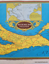
Genuine Antique Printed-Color Folding Map
circa 1935
Maker: Unknown.
Antique printed-color map of the Bermuda Islands, with an inset map showing the location of Bermuda in relation to Europe, North, and South America. Undated, believed to be from around 1935-1940. Features a decorative border, compass rose, and streets indicated by quality. With folds, as issued. Good overall antique condition with some minor stains and damage, and minor wear at the folds. Measures approximately 7.75" x 22.5" (H x W) to the neatline.
Item Number: CAR099


