1950s
Maker: Miro-Torres
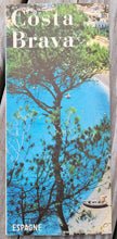
Vintage bird's-eye view map of part of Spain, Costa Brava on the Mediterranean. The Costa Brava is in northeastern Spain. Sources differ on the exact definition of the Costa Brava. Usually it can be regarded as stretching from the town of Blanes, 60 km northeast of Barcelona, to the French border – in other words it consists of the coast of the province of Girona. This vibrant map covers the whole of Costa Brava and shows automobile routes, railroads, camping, and gas stations. This map is undated but was likely published in the 1950s, based on the clothing worn in the photos. Very good condition with folds as issued. It was published as a tourism booklet and has staples at the center fold. Measures approx. 8.75 x 23.5 inches when unfolded.
Item Number: EUR3161


