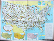
c. 1950
Maker: US Department of State.
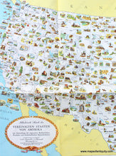
Antique printed color map of the United States published c. 1950 by the Department of State and copyright General Drafting Co, Inc. Printed in German. This map of the US features illustrations of regional resources, products, and natural features. An inset map in the upper right shows the location of the USA in relation to the rest of the world, while inset maps at the bottom show Principal Trunk-Line Railroads, Principal Air Routes and Terrain, and Principal Trunk Line Highways. The box of text gives Facts About the United States. This map was published many times in various iterations. This particular map was likely one of the earlier publications because it has nothing printed on the verso and was not sponsored by any companies. Good to very good condition, with folds as issued, and mild toning. Some wear along the folds. Approx. 23 x 31 inches to the neatlines.
Item Number: USA337


