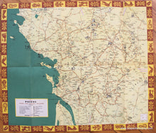
c. 1947
Maker: French Ministry of Travel.
Antique printed color folding tourist map of the areas near Poitiu, Vendee, Aunis, Saintonge, and Angoumois, France, published by the French Ministry of Travel, in English, including Nantes, Poitiers, Limoges, Fontenay-le-Comte, Saintes, and Perigueux, with roads, towns, villages, natural curiosities, religious edifices, megalithic monuments, battlefields, castles, spas, and more. Verso features narrative of the area and photographs of famous tourist attractions, c. 1947. Very good condition with vivid original color, pin holes at corners, measures approx. 17.5 x 20.5 inches unfolded.
Item Number: EUR2465


