Current hours: 10am to 5pm Monday through Saturday. 12pm to 5pm Sundays. IMPORTANT PLEASE NOTE: We have become aware that some of our photos have been stolen by other websites. Our maps are only available at our website www.mapsofantiquity.com or at our store!

Antique-Pictorial-Map-Booklet-Other-The-New-York-1939-Official-World's-Fair-Pictorial-Map-1939-Tony-Sarg--1900s-20th-century-Maps-of-Antiquity
  • Load image into Gallery viewer, Antique-Pictorial-Map-Booklet-Other-The-New-York-1939-Official-World's-Fair-Pictorial-Map-1939-Tony-Sarg--1900s-20th-century-Maps-of-Antiquity
  • Load image into Gallery viewer, Antique-Pictorial-Map-Booklet-Other-The-New-York-1939-Official-World's-Fair-Pictorial-Map-1939-Tony-Sarg--1900s-20th-century-Maps-of-Antiquity
  • Load image into Gallery viewer, Antique-Pictorial-Map-Booklet-Other-The-New-York-1939-Official-World's-Fair-Pictorial-Map-1939-Tony-Sarg--1900s-20th-century-Maps-of-Antiquity
  • Load image into Gallery viewer, Antique-Pictorial-Map-Booklet-Other-The-New-York-1939-Official-World's-Fair-Pictorial-Map-1939-Tony-Sarg--1900s-20th-century-Maps-of-Antiquity
  • Load image into Gallery viewer, Antique-Pictorial-Map-Booklet-Other-The-New-York-1939-Official-World's-Fair-Pictorial-Map-1939-Tony-Sarg--1900s-20th-century-Maps-of-Antiquity

1939 - The New York 1939 Official World's Fair Pictorial Map - Antique Booklet with Many Maps

Regular price
$150.00
Sale price
$150.00
Regular price
Sold out
Unit price
per 
Shipping calculated at checkout.

Item number: OTH362

Genuine Antique Pictorial Map Booklet

1939

Maker: Tony Sarg.


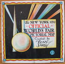
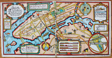
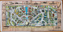
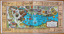
Antique printed color map booklet for the 1939 World's Fair in New York City. Colorful, fun, and immensely interesting, this booklet features several pictorial maps intended to guide visitors to and around the World's Fair. It was held at Flushing Meadows-Corona Park in Queens, New York. The first map in the book is a guide to getting there, showing major routes and public transport information. This map opens at the center to show an overview map of the fair itself. The following pages display the Exhibit Area, International Zone, Transportation Zone, and the Amusement Area. Each of the four maps have a key at the bottom and an illustrated border. Good to very good condition with some minor stains, a vertical fold at the middle of the booklet, a few minor creases at the edges. This map booklet is a bit fragile and should be handled with care. It could be framed to showcase one particular map with the others hidden. To show them all, reproductions would need to be made. The largest map measures approx. 11.25 x 44.5 inches. Most of the maps measure approx. 11.25 x 22.5 inches. 


Item Number: OTH362