Current hours: 10am to 5pm Tuesday through Saturday. We are closed Sundays and Mondays for the Winter. Proud to be a SMALL, LOCAL, CAPE COD BUSINESS! Maps of Antiquity is in its 38th year! Our maps are only available at our website www.mapsofantiquity.com or at our store!

Antique-Printed-Color-Map-The-Reaches-of-New-York-City-Greater-NYC-Manhattan-Long-Island-Westchester-Jersey-City-New-Jersey-Connecticut-United-States-New-York-1939-National-Geographic-Society-Maps-Of-Antiquity
  • Load image into Gallery viewer, Antique-Printed-Color-Map-The-Reaches-of-New-York-City-Greater-NYC-Manhattan-Long-Island-Westchester-Jersey-City-New-Jersey-Connecticut-United-States-New-York-1939-National-Geographic-Society-Maps-Of-Antiquity
  • Load image into Gallery viewer, Antique-Printed-Color-Map-The-Reaches-of-New-York-City-Greater-NYC-Manhattan-Long-Island-Westchester-Jersey-City-New-Jersey-Connecticut-United-States-New-York-1939-National-Geographic-Society-Maps-Of-Antiquity
  • Load image into Gallery viewer, Antique-Printed-Color-Map-The-Reaches-of-New-York-City-Greater-NYC-Manhattan-Long-Island-Westchester-Jersey-City-New-Jersey-Connecticut-United-States-New-York-1939-National-Geographic-Society-Maps-Of-Antiquity

1939 - The Reaches of New York City - Antique Map

Regular price
$85.00
Sale price
$85.00
Regular price
Sold out
Unit price
per 
Shipping calculated at checkout.
 More payment options

Pickup available at 1409 MAIN ST, CHATHAM MA

Usually ready in 24 hours

Item number: NYO672
Genuine Antique Printed-Color Map

1939

Maker: National Geographic Society.


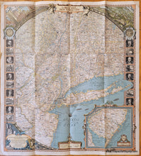
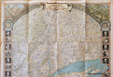
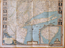
Antique printed-color map of part of New York, with New Jersey and Connecticut, published by The National Geographic Society in 1939. The map shows roads, towns, villages, and interesting facts, such as "Capt. Kidd buried treasure here" and "Radio transmitting station most powerful in the world." The map's borders are highly decorative with bird's eye views, images of important men and buildings of the area, and various decorative flourishes. An inset map in the lower right shows southern New Jersey. Very good condition with some slight edge wear. Has folds as issued. Approx. 29 x 26.25 inches to the edges of the sheet. 


Item Number: NYO672