Winter hours: Tuesday - Saturday 10am to 5pm. Close Sundays and Mondays until May. We appreciate your business!

Genuine-Antique-Map-A-Map-of-Exploration-in-the-Spanish-Southwest-1528-1793-1932-Lauritzen-Automobile-Club-of-Southern-California-Maps-Of-Antiquity
  • Load image into Gallery viewer, Genuine-Antique-Map-A-Map-of-Exploration-in-the-Spanish-Southwest-1528-1793-1932-Lauritzen-Automobile-Club-of-Southern-California-Maps-Of-Antiquity
  • Load image into Gallery viewer, Genuine-Antique-Map-A-Map-of-Exploration-in-the-Spanish-Southwest-1528-1793-1932-Lauritzen-Automobile-Club-of-Southern-California-Maps-Of-Antiquity
  • Load image into Gallery viewer, Genuine-Antique-Map-A-Map-of-Exploration-in-the-Spanish-Southwest-1528-1793-1932-Lauritzen-Automobile-Club-of-Southern-California-Maps-Of-Antiquity

1932 - A Map of Exploration in the Spanish Southwest 1528-1793 - Antique Map

Regular price
$150.00
Sale price
$150.00
Regular price
Sold out
Unit price
per 
Shipping calculated at checkout.

Item number: USA435
Genuine Antique Map

1932

Maker: Lauritzen / Automobile Club of Southern California

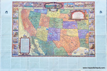
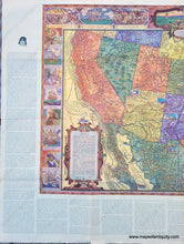
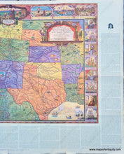
Antique printed-color map of the Southwestern US, painted by Dillon Lauritzen and published by the Automobile Club of Southern California in their Touring Topics Volume 24, Number 1, January 1932. This map shows the Southwest of the United States from Texas to California with the routes of explorers. It is delightfully adorned with illustrations of people and animals including two sea monsters. It includes extensive information about explorers complied by Joseph J. Hill and printed along the sides and bottom of the map (this could be folded under and hidden when framing). The decorative border of the map includes portraits of explorers and their vessels, and scenes from their explorations. Good antique condition. This paper is quite fragile and it has separated along the folds in many places, including at fold intersections within the map. Measures approx. 22 x 32.75 inches to the printed border of the map and 28 x 42 inches to the paper edges.

Item Number: USA435