Current hours: 10am to 5pm Monday through Saturday. 12pm to 5pm Sundays. IMPORTANT PLEASE NOTE: We have become aware that some of our photos have been stolen by other websites. Our maps are only available at our website www.mapsofantiquity.com or at our store!

Genuine-Vintage-Map-Danny-Arnolds-Pictorial-Map-of-the-Old-West-1970-Fran-Dowie-Old-Western-Trading-Post-Ltd--Maps-Of-Antiquity
1970 - Danny Arnold's Pictorial Map of the Old West - Vintage Map
  • Load image into Gallery viewer, Genuine-Vintage-Map-Danny-Arnolds-Pictorial-Map-of-the-Old-West-1970-Fran-Dowie-Old-Western-Trading-Post-Ltd--Maps-Of-Antiquity
  • Load image into Gallery viewer, 1970 - Danny Arnold's Pictorial Map of the Old West - Vintage Map
  • Load image into Gallery viewer, 1970 - Danny Arnold's Pictorial Map of the Old West - Vintage Map

1970 - Danny Arnold's Pictorial Map of the Old West - Vintage Map

Regular price
$350.00
Sale price
$350.00
Regular price
Sold out
Unit price
per 
Shipping calculated at checkout.

Item number: USA460

Genuine Vintage Map

1970

Maker: Fran Dowie / Old Western Trading Post Ltd.


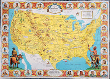
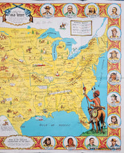
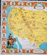
Vintage pictorial map of the United States "showing pioneer trails and battles, Indian's territories, stagecoach lines, military forts, historical data of the frontier period around 1840. Compiled and Illustrated by Fran Dowie." Colorful vintage map circa 1970 celebrating the Old West, first created around 1950 and published by the Old West Trading Post Ltd of London, England. Danny Arnold was the director of the Old West Trading Post from 1960 until his death. Filled with historical notations and illustrations. Border is populated with notable people including Jesse James, Calamity Jane, Crazy Horse, and many more. Vibrant color. Very good condition with folds, minor wear along the folds and some tiny separations at the fold intersections. Measures approx. 24.75 x 34.75 inches to the paper edges.

Genuine Vintage Map from 1970

Item Number: USA460