Winter hours: Tuesday - Saturday 10am to 5pm. Close Sundays and Mondays until May. We appreciate your business!

Antique-Printed-Color-Folding-Map-Birdseye-View-of-Puget-Sound-Country-and-Vicinity-1927-Puget-Sound-Navigation-Company-Maps-Of-Antiquity
  • Load image into Gallery viewer, Antique-Printed-Color-Folding-Map-Birdseye-View-of-Puget-Sound-Country-and-Vicinity-1927-Puget-Sound-Navigation-Company-Maps-Of-Antiquity
  • Load image into Gallery viewer, Antique-Printed-Color-Folding-Map-Birdseye-View-of-Puget-Sound-Country-and-Vicinity-1927-Puget-Sound-Navigation-Company-Maps-Of-Antiquity
  • Load image into Gallery viewer, Antique-Printed-Color-Folding-Map-Birdseye-View-of-Puget-Sound-Country-and-Vicinity-1927-Puget-Sound-Navigation-Company-Maps-Of-Antiquity

1927 - Birdseye View of Puget Sound Country and Vicinity - Antique Map

Regular price
$550.00
Sale price
$550.00
Regular price
Sold out
Unit price
per 
Shipping calculated at checkout.

Item number: WES445
Antique Printed Color Folding Map

1927

Maker: Puget Sound Navigation Company


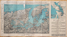
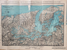
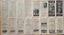
Antique printed color map of Puget Sound with the surrounding areas. Published in 1927 by Puget Sound Navigation Company. Includes Vancouver, Seattle, steamer routes, a map in the upper right with highway routes, and more. This was issued as a tourist map and verso includes detailed tourism information for the area. Map is in very good antique condition, with some separations at the fold intersections. This map was issued as a folding or pocket map and it retains the folds it had when issued. Approx. 13.5 x 19.75 inches to the neatline of the larger map. Total sheet dimensions are 16 x 29 inches. 


Item Number: WES445