Genuine Antique Hand Colored Map
1879
Maker: Walker.
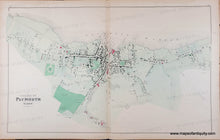
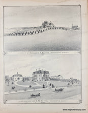
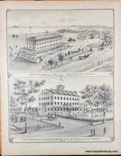
Genuine antique map from the Atlas of Plymouth County, MA, 1879, by Walker. Village of Plymouth, showing property owners, named streets, schools, churches, railroad and depot, National and Soldier's Monuments, numerous mills and waterfront along Plymouth Harbor; versos display illustrations of the Curtis and Keith estates, and of Plymouth's Clifford House and Samoset House. Very good overall antique condition, even toning, slight water stain at top edge, some tiny spots. Map measures approx. 16 x 25.5 inches to the neatline.
Genuine Antique Map from 1879
Item Number: MAS1504A


