Pickup available at 1409 MAIN ST, CHATHAM MA
Usually ready in 24 hours
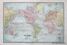
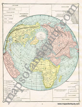
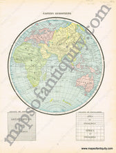
1894 - Chart of The World on Mercator's Projection, verso: Eastern Hemisphere, and Untitled Comparative Map - Antique Map
-
1409 MAIN ST, CHATHAM MA
Pickup available, usually ready in 24 hours1409 Main Street
Chatham MA 02633
United States+15089451660
1894
Maker: Cram.
Antique printed color double-sided sheet of world maps. Recto: A two-page Chart of the World on Mercator's Projection. Includes the land surface area, water surface area, and the populations of the Western and Eastern hemispheres at that time (map published in 1894). Also includes an image of a mariners compass at the bottom right corner of the map. Verso: On the fist page- A map of the Eastern Hemisphere. Includes the density of populations in Great Britain, Asia, and Africa. On the second page- An untitled map of the world, with focus on the North Pole (in later editions, this map is titled Greatest Mass of Land and Water). Includes the comparative areas of continents, principal islands, lakes, and oceans. Very good condition with some slight overall toning and some small tears at the edges of the page. By Cram, 1894, original atlas unknown. Verso map measures approximately 11.75" x 17.75" to the neatline. Map of the Eastern Hemisphere measures approx. 12" x 9.25" to include all content (No neatlines). Untitled map with comparative info. measures approx. 11.5" x 9" to the neatline. If you would like to purchase any of these maps separate from the others, please contact us.
Item Number: WOR189


