Pickup available at 1409 MAIN ST, CHATHAM MA
Usually ready in 24 hours
1913 - Official Parcel Post Map of the United States - Antique Map
-
1409 MAIN ST, CHATHAM MA
Pickup available, usually ready in 24 hours1409 Main Street
Chatham MA 02633
United States+15089451660
1913
Maker: US Geological Survey / US Postal Service
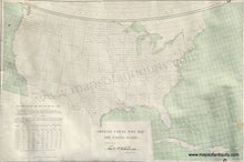
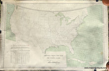
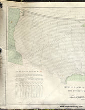
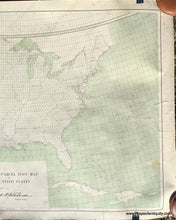
Antique printed color map of the United States, printed by the US Geological Survey and approved by the Postmaster General in 1913. This rare map was for use in location 566, which was southeastern Connecticut and also the eastern tip of Long Island. The entire country is overlaid with a grid, each square containing the numbered location. Over that is printed in red many concentric circles showing the widening distance from location 566. Using this map, one could calculate the cost of postage with the table in the lower left corner. Before 1913, if you wanted to mail a parcel weighing more than four pounds, you had to use a private express company. Americans, tired of high and unpredictable express company rates, demanded a public parcels service. After decades of debate, the service was finally instituted on New Year €™s Day in 1913. This map was the first ever US Postal Service Parcel Post map. It map almost certainly was kept at a post office in the speficied location but when the rates were changed, perhaps someone saved it from being thrown out. The only example of a similar map that we can find is in the National Postal Museum, although their example is (of course) centered on Washington DC. An incredible piece of postal history! Good to very good antique condition condition with some minor surface soil, some stains, some horizontal wrinkles, slight roughing at the paper edges. Measures approx. 22 x 33.25 inches to the neatline.
Item Number: USA401


