Current hours: 10am to 5pm Monday through Saturday. 12pm to 5pm Sundays. IMPORTANT PLEASE NOTE: We have become aware that some of our photos have been stolen by other websites. Our maps are only available at our website www.mapsofantiquity.com or at our store!

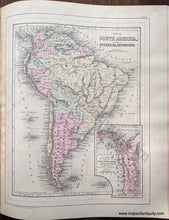
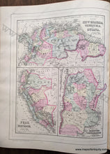
Antique-Hand-Colored-Map-Double-sided-map:-Map-of-South-America-showing-its-Political-Divisions;-verso:-Map-of-New-Granada-Venezuela-and-Guiana-/-Map-of-Peru-and-Equador-/-Map-of-the-Argentine-Confederation-South-America--1884-Mitchell-Maps-Of-Antiquity-1800s-19th-century
1884 - Double-sided map: Map of South America showing its Political Divisions; verso: Map of New Granada, Venezuela, and Guiana / Map of Peru and Equador / Map of the Argentine Confederation - Antique Map
  • Load image into Gallery viewer, Antique-Hand-Colored-Map-Double-sided-map:-Map-of-South-America-showing-its-Political-Divisions;-verso:-Map-of-New-Granada-Venezuela-and-Guiana-/-Map-of-Peru-and-Equador-/-Map-of-the-Argentine-Confederation-South-America--1884-Mitchell-Maps-Of-Antiquity-1800s-19th-century
  • Load image into Gallery viewer, 1884 - Double-sided map: Map of South America showing its Political Divisions; verso: Map of New Granada, Venezuela, and Guiana / Map of Peru and Equador / Map of the Argentine Confederation - Antique Map

1884 - Double-sided map: Map of South America showing its Political Divisions; verso: Map of New Granada, Venezuela, and Guiana / Map of Peru and Equador / Map of the Argentine Confederation - Antique Map

Regular price
$50.00
Sale price
$50.00
Regular price
Sold out
Unit price
per 
Shipping calculated at checkout.

Item number: SAM402
Genuine Antique Hand Colored Map

1884

Maker: Mitchell.

Antique hand colored maps from Mitchell's 1884 New General Atlas. On one side of this page is a map of South America, on the other side are three maps of South American countries: Colombia, Venezuela, Guyana, Suriname, and French Guiana, Ecuador and Peru, and Argentina. Shows railways, political boundaries, cities, water bodies, as well as land features. Colored by country / region. This map is in very good antique condition with minor overall toning. Paper is a bit fragile. Page measures approximately 15 x 12 inches.

Item Number: SAM402